
The Northern Cape is the largest province of South Africa, it was established in 1994 and occupies part of the territory of the pre-existing Cape Province, that was divided into 3 different regions.
The province of Northern Cape has as its chief town the city of Kimberly and is bordered by Botswana and Namibia to the North and the South African regions of North West, Free Stateand Eastern Capeto the East, while to the South and West are respectively the Western Capeprovince and the Atlantic Ocean.
From a geological point of view the province is divided into three regions, the Karoo basin to the South, the Southern section of the Kalahari to the North, characterized by the flow of the Orange River, and the coastal region of Namaqualand.
The Orange River flows in the territory, mostly arid and semi-desert, of the Kalahari, along its banks is a lush area called Green Kalahari, where there are protected natural zones, wine-growing areas and fertile plains, that are cultivated from the night of times by the San.
The extraction of diamonds has represented, and still represents, the main source of income for the province; important mines can be found both in the Kimberly area and on the ocean coast.
The cold stream of Benguela means that the Atlantic Ocean, in this area as well as in Namibia and Angola, is very fishy; fishing is one of the most profitable activities in the province.
What to see in the Northern Cape Province.
The city of Kimberly, in addition to being the capital of the province, is considered the "world capital of diamonds", in the Northern Cape is in fact the so-called "diamond region", where, in 1866, the excavations began to look for the precious gems.
Although many mines are now exhausted, the city remains an important center for trade and for carving diamonds, here there is the "big hole", the largest hand-carved crater in the world; excavated by miners in the past to extract diamonds, today it is a tourist attraction where there is a museum, the reconstruction of a village of miners and of course the huge hole that has a circumference of 1.6 km and it is 215 meters deep.
The province of Northern Cape hosts six national parks in its territory, two of which are located in the Northern part of the province and are cross-border with Namibia and Botswana: the Kgalagadi Transfrontier Park and the | Ai- | Ais / Richtersveld Cross-border Park, that hosts the Fish River Canyon in Namibia.
Nature plays a major role in this province and it is estimated that in the Northern Cape there are 5,400 different species of plants, 30% of which are endemic.
The Karoo area is characterized by immense spaces and numerous livestock farms, the zone is a semi-arid region that however changes during the rainy season, dyeing the bright green of the meadows and hosting the Mokala National Park; the park takes its name from the typical plant of the area that is used by local populations for traditional medicine.
In addition to the flora, the park is home to numerous animal species, including black and white rhinos.
The South African area of the Kalahari desert is divided into two distinct zones, an arid and desert part, characterized by sand dunes shaped by the wind, and the Green Kalahari, a fertile area irrigated by the Orange River, that gives life to fruit crops and vineyards.
The Orange River gives life to the sixth highest waterfall in the world, with a jump of about 60 meters the river plunges into an 18 km long and 240 meters deep gorge; the rapids and waterfalls of the river are protected by the Augrabies Falls National Park.
The Kalahari area is dotted with quiver trees, a tree with a unique silhouette and charm; it is possible to admire the Quiver Tree Forest, an unusual forest composed of about 250 quiver trees, so called because its branches are traditionally used by the Bushmen, or San, to build the quivers of their arrows.
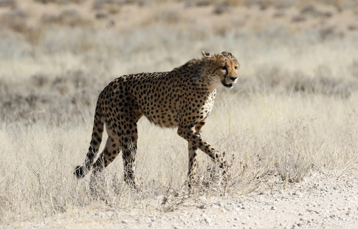
The region also hosts the Kgalagadi Transfrontier Park, a park of incredible beauty where the sand dunes create the ideal setting to spot the black mane lions and many other animals such as springboks, wild dogs, elands, cheetahs, leopards, zebras, oryxes and many other species; in the park there are also numerous bird species.
In addition to incredible safaris, the park is also famous for its unique landscape, the high red sand dunes alternate with areas with low thorny shrubs and dry riverbeds and then return to enchant with white or yellowish dunes, that light up with the colors of the sunset.
Finally, the Namaqualand region, that owes its name to the Nama, who have been living in these lands long before the European settlers landed on the coasts of South Africa.
Namaqualand, or Namakwa, houses two national parks: the Namaqua National Park and the Richtersveld National Park.
The Richtersveld National Park is located in the North-Western part of Namaqualand and forms, together with the Namibian | Ai- | Ais Hot Spring Game Park, a vast cross-border park, that offers incredible 4x4 routes and exceptional excursions for birdwatchers.
The Namaqua National Park is a coastal park characterized by rolling hills, but what makes it an authentic masterpiece of nature is the desert bloom.
In fact, in spring, between August and September, the desert is transformed, for a few weeks, into an endless expanse of colorful flowers; the flowery desert is an unforgettable sight that is repeated every year with the arrival of the first rains coming from the Atlantic.