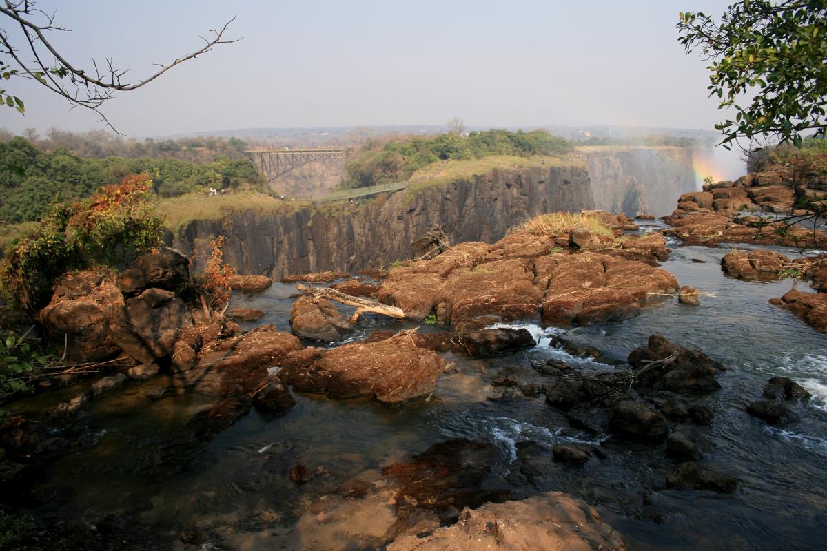

The Victoria Falls were formed during the Jurassic period when, as a result of a volcanic activity, a thick basalt deposit covered an extensive area in Southern Africa.
When the lava solidified, there were cracks in the rock that, over the centuries, became filled with softer materials that were progressively eroded by the mighty Zambezi River.
The erosion process is still ongoing today and the river constantly changes its course.
Some stone artifacts dating back to 3 million years ago have been found that suggest that there were specimens of Homo habilis in the area; some weapons, ornaments and some stone age tools dating to 50,000 years ago have also been found.
The Khoisan, a hunter and gatherer population of Southern African origin, supplanted these populations also through the use of iron to build tools and weapons; subsequently, here lived several popultaions, each of them called the waterfalls with a different name: the Tokaleya, also known as the Batonga, called them "Shongu na mutilima", the Ndebele who came here later called them "aManz'a Thunqayo" and then came the Batswana and finally the Makololo who called them "Mosi-oa-Tunya" that means "the smoke that thunders".
A map of 1750, designed by Jacques Nicolas Bellin, indicated the presence of cataracts at the point where the Victory Falls are located, that in turn were already present on a map of 1715.
But the Victory Falls, so far only known to the local populations, to the Voortrekker and the Arabs who called them "the end of the world," became famous in the world when the Scottish explorer David Livingstone discovered them a century later; even though he was already aware of their existence.
On November 16, 1855, Livingstone came here during his journey along the Zambezi River from the top to the mouth; the journey lasted several years, from 1852 to 1856, and aimed at discovering new commercial routes.
David Livingstone had already discovered the Ngonye Falls, more upstream, and he was impressed but never how much he was impressed by the Victoria Falls; he also reached the small island that is located just before the jump and divides the waterfall cataracts, today the island is named after the famous explorer: Livingstone Island.
Livingstone decided to rename the waterfalls and, in honor of Queen Victoria, called them Victoria Falls.
In 1860 Livingstone returned to the waterfalls along with John Kirk to deepen his studies; then other European explorers arrived here, such as the Portuguese Serpa Pinto and the Czech Emil Holub, who in 1875 detailed the waterfalls for the first time; not least the British artist Thomas Baines who performed some early fall paintings.
In 1905, on the cascade gorges, a railway bridge was built, part of the enormous, never-realized project of the British entrepreneur Cecil Rhodes to connect Cape Town to Cairo.
The construction of the railway and bridge made the waterfalls more accessible to visitors from Cape Town or from the Belgian Congo during the period of British colonial rule; in 1904 the Victoria Falls Hotel opened to welcome visitors.
Visitors declined in the 1970s when in todays’ Zimbabwe riots broke out in the aftermath of the self-proclamation of independence not recognized by the International community; while in Zambia, having gained independence, the whites were seen with suspicion under the first president of the country, Kenneth Kaunda; at that time the border between the two countries was closed until 1980, when Robert Mugabe came into power in Zimbabwe.
In the 1980s tourists came back, especially on the Zimbabwe side of the falls, where the best structures were located; in 2000, however, the situation reversed because, following the regime of Robert Mugabe, Zimbabwe had a period of disorders, as a result of which tourists began to attend the Zambian side of the Victoria Falls.